

Welcome to our comprehensive guide for the Dragon’s Tooth hike in Jefferson National Forest / Appalachian Trail, Virginia! Whether you seek stunning mountain panoramic views, cascading waterfalls, or rugged rock scrambles near the DC metro area, this classic Virginia destination delivers an unforgettable adventure for all outdoor enthusiasts.
Essential Trail Summary & Elevation Overview
Key Trail Metrics
Planning your hike carefully ensures a safe and rewarding experience. Therefore, review these vital route facts before heading out to the trailhead:
- Total Distance: 4.6 miles round-trip loop
- Elevation Profile: 1,600 ft gain
- Route Difficulty: Strenuous (Rock Spine)
- Geographic Location: Jefferson National Forest / Appalachian Trail, Virginia
- Trailhead GPS Coordinates: 37.3725, -80.1671
Getting There: Route Directions & Parking Logistics
Driving From Washington, DC
Most hikers traveling from the Washington, DC metropolitan area can easily reach the trailhead in two to three hours. Specifically, take I-66 West toward Front Royal or US-29 South through Warrenton. As a result, you will enjoy scenic countryside views along your drive.
Parking Advice and Early Arrival
Because this trail is extremely popular among local hiking groups, parking lots fill rapidly on sunny weekends. Consequently, we strongly advise arriving before 8:00 AM. In addition, always carry a valid park pass or entry permit when required.
Interactive Trailhead Google Map
Use the live interactive GPS navigation map below to navigate directly to the Dragon’s Tooth trailhead parking area:
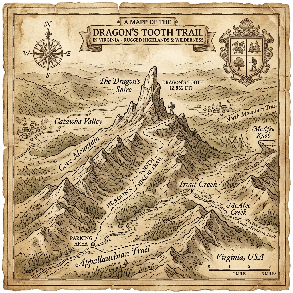
Historic Topographical & Olde World Trail Map
Explore this archival vintage route cartography detailing the elevation contours, ridgelines, and terrain of Dragon’s Tooth:
Interactive Trailhead Map & Community Event Guide
Plan Your Trip & Read Hiker Reviews
Furthermore, you can check live trailhead conditions, leave community reviews, and find upcoming weekend hiking group meetups below:
[em_venue id=10816]
(Explore the permanent Dragon’s Tooth Trailhead Hub for user reviews, photo submissions, and live trailhead updates.)
The Hiking Experience: Highlights, Waypoints & Scenic Overlooks
Ascending the Ridge Path
The journey begins under a lush canopy of native Virginia hardwoods. As you climb gradually, the trail transitions into rocky switchbacks and open boulder fields. Because the terrain is rocky and varied, each section offers a unique natural perspective.
Reaching the Panoramic Lookout
When you reach the summit or primary viewpoint, sweeping panoramic vistas of the Blue Ridge Mountains stretch out before you. For this reason, many hikers pause here to enjoy a well-deserved trail lunch and capture memorable photos.
Recommended Gear Checklist & Outdoor Apparel
Essential Day Pack Items
To stay comfortable and safe across changing mountain weather, pack sturdy high-traction hiking boots, plenty of drinking water, high-energy snacks, and dependable layers.

DJ TrailMix AOP Windbreaker — White Colorway
Lightweight, weather-resistant all-over print windbreaker designed for summit breezes, rocky trails, and morning hikes.
Safety Precautions & Leave No Trace Principles
Staying Safe on Mountain Trails
Cell phone reception can be intermittent in deep hollows and high ridges. Consequently, download your offline digital map before starting. Furthermore, always check local weather forecasts for sudden afternoon thunderstorms.
Protecting Virginia’s Natural Wilderness
Lastly, protect these pristine mountain ecosystems by packing out all trash and staying on designated paths. By practicing Leave No Trace ethics, we preserve Virginia’s beloved trail network for generations to come.
Verified Falcon Guide Route
This trail guide is curated from our comprehensive Virginia hiking series. For detailed topographical elevation maps and historical route trivia, explore the complete guide:
Curated Literature & Washington DC Downtown Calendar
The Architecture of Focus: Deep Work & Modern Mastery
By Founders Library Press
A structured framework for strategic clarity, productivity, and authentic execution.
Upcoming Downtown Happenings
Live acoustic sessions, gallery receptions, literary salons, and independent trade shows across Washington DC.
